Oberamtsgrenztafel
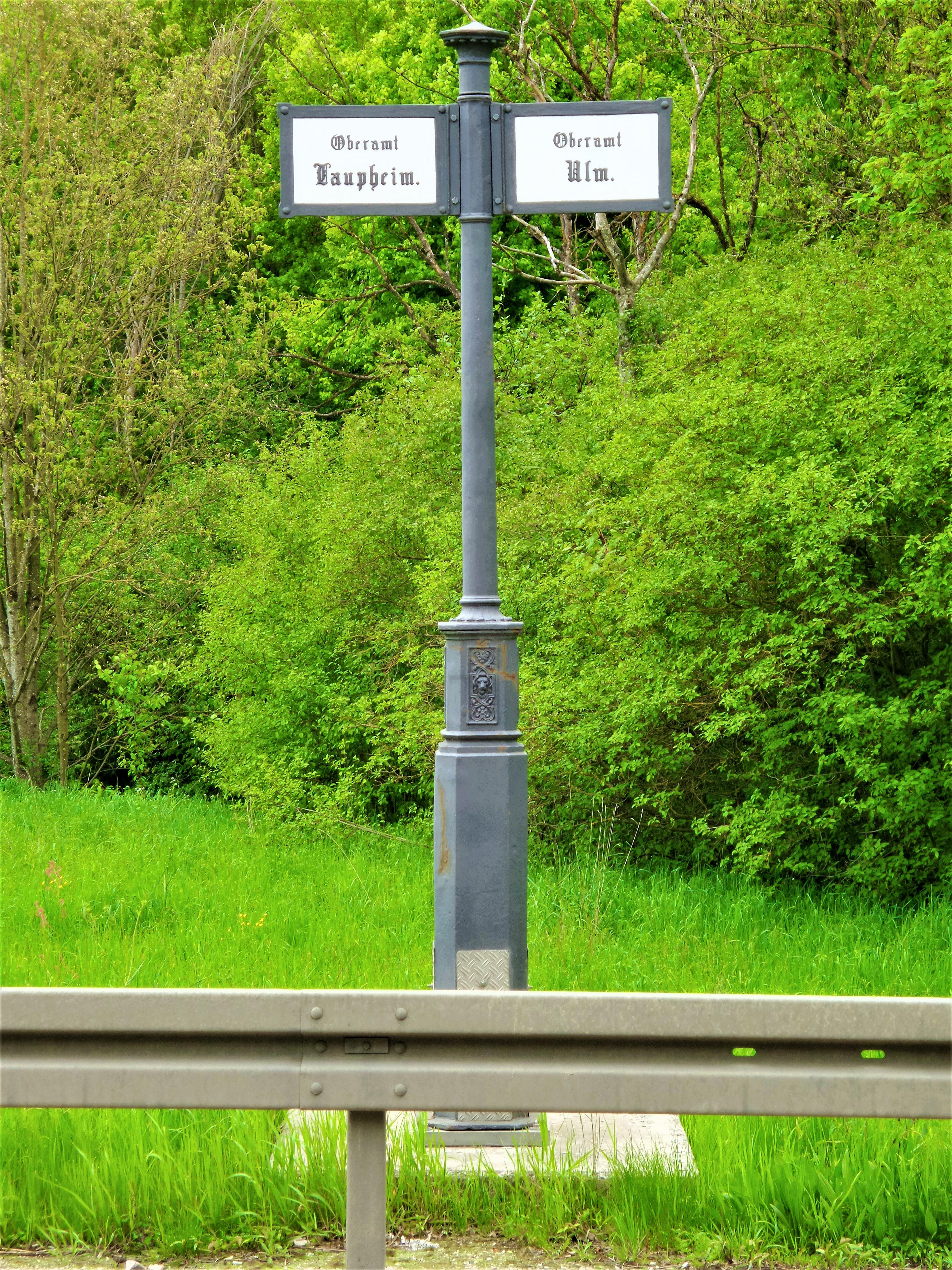
Oberamtsgrenztafel stands in Ulm as a historical boundary marker from Württemberg’s former administrative landscape. It marked the boundary between the Oberämter Ulm and Laupheim.
The marker belongs to historical signage known in Württemberg as Ortstafeln, which marked boundaries and provided directions. Its purpose was to mark an administrative boundary. These signs helped organise regional government and made territorial divisions visible. They also expressed a region’s territorial identity.
Historical examples were often made from cast iron and carried inscriptions in Fraktur. Fraktur is a traditional script used in German writing. Within Württemberg, such markers formed part of a wider system of historical signs. That system marked borders and offered practical directions.
The Ulm example represents the administrative distinction between Oberamt Ulm and Oberamt Laupheim. That distinction belongs to the region’s past governance. Clear demarcations mattered for governance and jurisdiction during the nineteenth century. The marker connects Ulm with that administrative history. It shows how regional authority shaped the landscape.
- City
- Ulm
- Content updated
Take this page with you
The myTuur app is free, and once you are standing at a spot its story starts by itself.


Spots like this one are the stops myTuur strings into tours through Ulm. In the app, each story begins where you stand: walk up to a spot and it starts, read it on screen or listen as you go, then follow the route to the next one.
What is myTuur?
myTuur is a free city-guide app. Its tours are built from spots, and each spot carries a story that starts when you get there, to read or to listen to as you like.